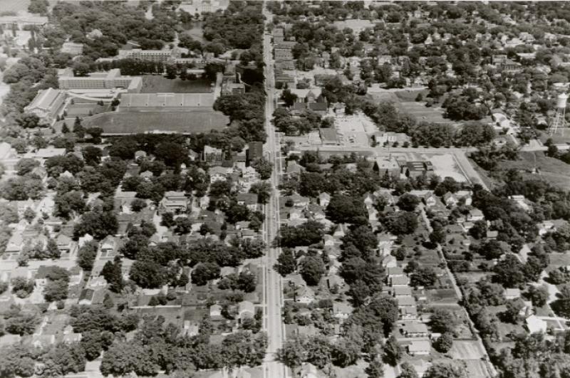
The Iowa Highway Commission's aerial photograph of the campustown area of Ames, taken on June 1, 1959. Orientation is looking east with Lincoln Way in the center of the photograph. Iowa State University's campus with the old Clyde Williams Field is seen in the upper left quadrant. The photo was taken several blocks west of Sheldon Avenue. It shows Lincoln Way when it was still two lanes in width. Iowa State College became Iowa State University in 1958. This is one of a series of aerial photographs taken in preparation for the widening of Highway 30 (Lincoln Way) to four lanes.
Citation: 206.1171.1-2
Year: 1959