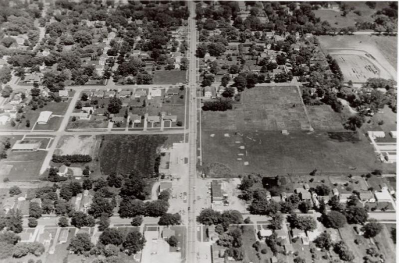
The Iowa Highway Commission's aerial photograph, taken June 1, 1959, showing Lincoln Way through the center and Franklin Avenue and the U. S. Highway 30 interchange in the immediate foreground, running left to right (or north to south). Orientation of the photograph is east. The area in the upper right hand corner of the photograph is the athletic field for Welch Junior High School (after 1986, Ames Middle School). At the intersection of Lincoln Way and Franklin are two service stations (Dyer's Standard and Alignment Service and Alfred's Service) and the Campus Court Motel. This is one of a series of aerial photographs taken in preparation for the widening of Highway 30 (Lincoln Way) to four lanes.
Citation: 206.1171.4
Year: 1959