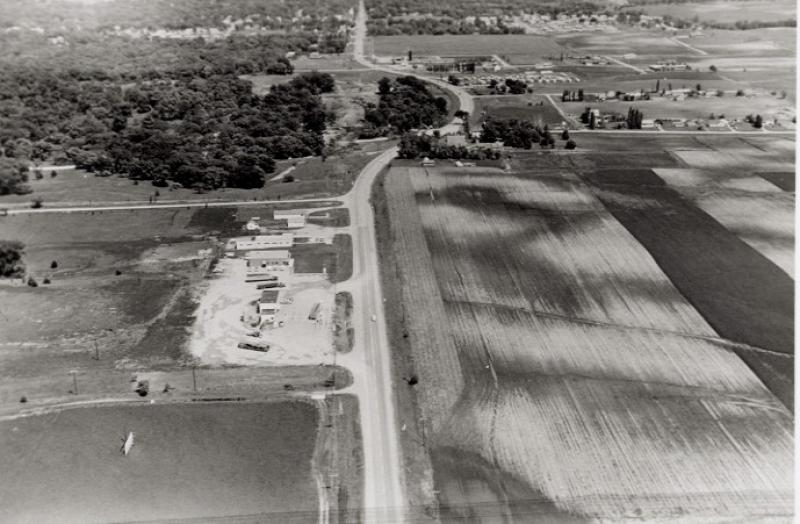
Iowa Highway Commission's aerial west of Ames on U.S. Highway 30 looking eastward, taken on June 1, 1959. The curved street in the upper center of the photo is Lincoln Swing. The curve begins on the west side of the North/South Dakota Avenue intersection. This is one of a series of aerials taken in preparation for the widening of Highway 30/Lincoln Way to four lanes. Note the general lack of development in the lower quadrants of the photo.
Citation: 207.1172.1
Year: 1959